Wednesday, July 28, 2010

A Relaxed Day

We didn't have anything planned for Wednesday, so let serendipity reign.  Started by admiring the snow-capped Olympics - they were contrasted against the blue sky, nevermind the fog bank along the shore.  We wandered east along the Sequim and Dungeness shoreline and around Discovery Bay to Port Townsend.  Sequim is in the lee of the Olympics and protected against much of the rain to the west - and consequently has grown greatly in the past decade, with nice places near the coast and tracts inland.
Port Townsend

Port Townsend is an old Victorian town at the northeast corner of the Olympic Peninsula - the main street down by the water, the next major street 100' up on the bluff. 
At the Ft. Worden Beach
 Joan and I have a very good friend in Port Townsend who has been caring for her now-deceased mother and will soon move to New Orleans.  She joined us for a picnic at Ft. Worden beach.  There have been many coast artillery forts along the Pacific coast - that was Ft. Worden's role before it was retired as a State Park and the quarters converted into a B and B that makes for a great venue for family reunions.  The beach faces out on Puget Sound, a favorite for picnics and walks - water is "wake up in a hurry" cold.
Sailing Past the Fog

We took the ferry across to Keystone on Whidbey Island, landing by a campground in sunshine, protected by the Fort Casey (another retired Coast Artillery fort) headlands.  Up on the headlands the 100+ runners in a training program emerged from and disappeared into the fog.  We went up the western coast, opposite the mouth of the Straits of Juan de Fuca and found Fort Ebey equally fogbound.  So we turned to Coupeville, on the eastern, sunny side of the island, watching a regatta sailing in Penn Cove.  We meandered southeast alongside Saratoga Passage through Langley toward the ferry at Clinton.  When things got tacky on The Sea Ranch Board, I used to say it was time to move to Whidbey - the west side is more like Sea Ranch, but Langley's sun and wind protection are very appealing.
Approaching Mukilteo

The ferry from Clinton to Mukilteo, on the mainland, is a short ride - 20 minutes.  The drive from the Mukilteo ferry terminal to I-5 took us past the Boeing plant where 747s, 767s, 777s, and now 787s, are assembled.  It used to be the largest manufacturing plant in the world, probably still is.  Worth a tour, but we were there too late.

We finished the day, and Harriett's tour at one of Seattle's iconic restaurants, Ivar's Salmon House, looking down Lake Union at the Space Needle.

All in all, a very successful 10 days, notable for many comfortable joys, much humor, and a general sense of an experience well worth building upon.  For Joan and me, there was the extra wonder of having seen all the major peaks in the Cascades from Mt. Shasta to Mt. Baker on one trip.

Tuesday, July 27, 2010

Victoria and Butchart Gardens

Port Angeles is an hour's passenger ferry ride from Victoria, the capitol of British Columbia, on Vancouver Island.  So bright and early (7:30 - early for us) Tuesday morning we found ourselves at the dock for the Victoria Express.  We had a bumpy crossing under a thick marine layer - apparently we were being broadsided by the tide - but the sun was shining over Canada.  We came into Victoria watching the commuter seaplanes come in and out of their terminal in the Inner Harbor.
There's lots to see and do in Victoria, but the big attraction for us is Butchart Gardens.  Butchard Gardens was the magnificent dream of the Butchards, owners of a played out limestone quarry about 15 miles from the ferry.  Over thirty or more years, they transformed a hole in the ground into 55 acres of gardens on a 155 acre estate called Benvenuto - the gardens are as welcoming as the name.
Looking Down on the Sunken Garden

Into the Rose Garden
We used the local, very efficient public transit to get there.  Butchard Gardens is a place that deserves days - there are so many species of flowers and ornamental plants, and they play continuously against the changing light.  Each of the thematic gardens - the Sunken Garden, the Bog Garden,  the Japanese Garden, the Rose Garden, the Italian Garden, the Mediterranean Garden - all deserve hours.  In the background, we heard the Victoria Symphony rehearsing Mozart for a concert on the Concert Green.  Needless to say, we stayed until we had to get the bus back to our ferry.
Joan and Jim in the Japanese Garden
Harriett of the Flowers

Back in Victoria, we had time to look into the Empress Hotel, modernized and expanded since Joan and her Mom had tea there 40 years ago, but not particularly welcoming now.   We also admired the Parliament Building.


The trip back to Port Angeles was calmer.  It was also slower because we encountered a thick fog bank halfway across.  We spent our time planning our next trip to Victoria.

Monday, July 26, 2010

Olympic National Park: Marymere Falls and Hurricane Ridge


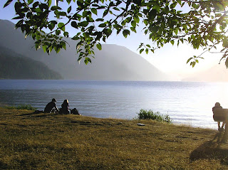
Monday, the 19th, Joan's and my wedding anniversary, we woke to the magic of early morning Crescent Lake.  The sky was clear, with just a bit of fog in the valleys.  Lazy, hearty breakfast at the Lodge, immersed in the peace of the lakefront.
Moments of Time Trail
Reluctant to leave the area, we went off on the Moments of Time Trail, but after a half mile or so switched onto the trail to Marymere Falls.  The trail passes through rain forest up to the base of the nearby mountain.  Then it's up a steep trail to a lookout.  The falls aren't as big as the ones we saw along the Columbia, but beautiful with the mesmerizing effects of falling water.

At noon we left for Port Angeles and the road to Hurricane Ridge.  In Port Angeles, we could see the Olympic Mountains and the bright snow. 

As we went up the road to Hurricane Ridge, we stopped at the lookouts, looking down on Port Angeles and Sequim - but not able to see Victoria through the haze along Vancouver Island.  By the time we reached the mile-high Hurricane Ridge visitors center, the air was crystal clear and the mountains with their glaciers seemed very close indeed. 

Joan and I were at Hurricane Ridge last year when it was equally clear, but there was less haze down on the Straits of Juan de Fuca.  We did the Hurricane Hill trail last year (huff, puff), but this year confined ourselves to the trails around the visitors center.

View from Ediz Hook
We left the spectacular mountain views in late afternoon and rolled down to Port Angeles.  We drove through the (now-Japanese) paper mill out onto Ediz Hook, the breakwater for Port Angeles' harbor.  It's about a three mile drive to the Coast Guard station at the tip.  We had another grand view of the Olympics, but Canada was obscured by haze.  A raccoon - how did he get out there? - kept track of us as we used camera and binoculars.

Sunday, July 25, 2010

Olympic National Park - Rainforests

The Largest (?) Sitka Spruce

Sunday morning started in grey drizzle.  By the time we got to Lake Quinault, the clouds were beginning to lighten.  There we went east along the south shore past Lake Quinault Lodge to see what is advertized as the largest Sitka Spruce - maybe yes, maybe no, but it sure is big.

We followed that by driving along the north shore to a ranger station and nature trail - that is very well done and very informative.  Some parts of the trail reminded me of east Texas bayous.
Then north on US 101 toward the Pacific.  As the sun came out, we stopped for lunch at Klaloch Lodge (quite good) on the beach, then continued up 101 to the road into the Hoh Valley Rainforest.  It's a beautiful 18 mile drive to a visitors center and the heads of several trails.  We took the Spruce Trail, which covers a variety of ecologies including those along the Hoh River.  Again, we learned a lot, and enjoyed another sort of natural wonder.

The day ended at a very special place - Lake Crescent Lodge.  Lake Crescent is a gem in the northwestern corner of Olympic National Park.  A deep crescent shaped lake perhaps five miles long, Lake Crescent has  steep mountains on both sides.  The Lodge is an old-style resort hotel with a couple of dozen old cabins and some motel rooms.  It reminds me of the Watson House, an old hotel that sat at the end of a lake in the Poconos that my family knew 60 years ago.  It is a place of calm and quiet.
 The dining room was crowded by two large parties and reservations were not available until 9:00, so we opted to sit in the sunroom and order from the bar menu.  Bingo!  We won the jackpot!  We ate (and drank our Washington State wine) with an unobstructed view of the lake at sunset.  It really is a perfect place.

Mt. St. Helens

Friday, we left Kelso, drove north 10 miles on I-5 to Castle Rock, and turned east toward the Mt. St Helens National Volcanic Monument.

We started off under clouds that dribbled from time to time and climbed into and through the clouds.  As we broke out of them, we found ourselves looking straight at the mountain, brilliantly illuminated.  We started by going out to Johnston Observatory - the combination reseach center and visitors center at the end of road from the west.  The visitors center is very well done - our tax dollars were spent effectively.  We could see all the details of the site of the eruption, where the side of the mountain was blown out and where a new volcanic cone is growing.  We also could see the new Spirit Lake, 150' or more above the location of the one Joan and her family knew.
The New Spirit Lake


Joan and her family have had a connection with Mt. St. Helens almost since they moved to Tacoma from Kansas.  The Episcopal Church did summer camps for kids and families at Harry Truman's lodge on Spirit Lake, and they have fond memories of both the lake and the mountain - and of the crusty Harry Truman who among other things ran the camp store.

My connection with the mountain is more tenuous.  In 1980, the guys in IBM's Palo Alto Scientific Center used a bunch of then-new image enhancement technology to produce a satellite-sourced digital image of the eruption of Mt. St. Helens, showing the plume extending into eastern Washington.  Our friends in Pullman told us of the ash that covered the entire area. 

Joan, her Mom, and the kids saw much of the downstream devastation in 1981.  Over the years, we've watched the rebirth of the ecology, going closer and closer to the mountain as the roads were opened and Visitor Centers completed.  Some of the trees on Weyerhauser land that we had seen as freshly planted in the early '80s are nearing maturity.

As we turned back toward I-5, we stopped at the lookout by a visitor center seven miles west of Johnston Observatory.  That center was closed in 2007 after Johnston Observatory opened.  The National Volcanic Monument is a laboratory for the study of the environmental dynamics following an eruption.  No interventions are allowed, so everything that has happened is natural. 
View across the National Volcanic Monument from Weyerhauser's Center

In contrast, the environment of the Weyerhauser forests is being closely managed.  After the trees knocked over or killed were harvested, about 40,000 acres of trees were planted.  Weyerhauser has a visitors center on its property, looking up at Mt. St. Helens and educating/propagandizing for the lumber industry.  The center is worth the 45 minutes that we spent there.
Weyerhauser's post-1980 Tree Farm

The county built a small visitors center on the road to the mountain - in the early time after the eruption it was as far up the road one could drive.  It is particularly interesting for its Spirit Lake memorabilia.
 View from the County Center

The master plan had us going to Astoria and Ft. Clatsop (where Lewis and Clark wintered), but we didn't leave Mt. St. Helens until late afternoon.  So going back to Oregon wasn't in the cards and we headed cross-country to Hoquiam on Gray's Harbor in southwestern Washington.  Along the way, we had one stretch of road where we had to compete for road space with several hundred Seattle-to-Portland bicyclists.  As we got near the coast, the contrast with the mountain was dramatic as we were in a cool drizzle.  The forecast for Saturday wasn't a positive one, but after all we were going to be touring rain forests.

Thursday, July 22, 2010

Crater Lake to Kelso

Yes, there will be more photos.  Problem is that the files are too big for dial-up connections - I'll upload them when we find a broadband one.
On Thursday morning, after breakfast at Mazama Village - the cafe there is nicer than the ones at the Grand Canyon and Bryce - we went back up to the rim.  I had a telephone call with the Diocesan Standing Committee, while Joan and Harriett lolled reading on the Crater Lake Lodge terrace overlooking the Lake, which was showing off its morning blue.

We left Crater Lake shortly before noon, dropping down to Rt. 97 east of the Cascades.  All the mountains on our way north through Bend and Redmond were dressed with snow and it was clear enough to see them entirely.  We aimed for The Dalles and turned west on I-84 through the Columbia Gorge.  We stopped at various lookouts and at the Cascade Locks with its historical displays and pleasant walk out along thre Columbia.  Then we found old US Route 30, carved from the face of the cliffs Highway 1 style, and stopped at the Horse Tail Falls and at the more famous Multnomah Falls.  Joan's Dad and brother, Ritchie, drove west from Kansas on Rt. 30 in 1957 - Ritchie still talks of the surprise and awe he felt, having grown up in the Middle West.

The long day ended in Kelso, positioned to go up to Mt. St. Helen in the morning.

Crater Lake

Thursday morning we drove up to Crater Lake.  The appetizer along the drive from Roseburg is Diamond Lake, with the relatively small volcano, Mt. Bailey, behind it.

July 15, 2010
June 2, 2008
Crater Lake is a gem unlike any place we know.  The blue of the lake is unforgettable.  Once again we were there with clear blue skies.  Last time we were at Crater Lake, it was the start of June, 2008, and all but the road from the south entrance to the Crater Lake Lodge was under several feet of snow.  This time, all the roads were open, although there were patches of snow along the road, and the road along the east rim had been open only for a week.

We stopped at several lookouts along the west rim road, looking at the ever-varying patterns and reflections on the lake surface, before having lunch at the Lodge.  It's well worth lunching at the Lodge rather than at the cafe.

Add caption
 There's a new amenity at Crater Lake - a trolley tour around the rim in good looking "trolleys" that stopped at several lookouts including ones on the east rim road, a road that had been open this year for less than a week.  In addition to the driver, we had a Park Ranger on board who provided an enormous amount of information about Crater Lake, its history, geology, and flora and fauna.  Well worth it, especially for the guy - me - who would have been the driver had we simply driven around the Lake.  Along the way, the Ranger pointed out the many nearby volcanos - and the not so close Mt. Shasta, about 100 miles away.
Looking Across Crater Lake toward Mt. Scott
The Phantom Ship from the East Rim
 We ended the day in a cabin of the Mazama Village Inn - tried to get a reservation at the Lodge in March, but it was already booked up.  Mazama Village is OK, however.  Friday morning, we went back up to the rim.  I did a teleconference with the monthly Diocesan Standing Committee while Joan and Harriett sat on the Lodge's terrace, sometimes enjoying the view, sometimes reading.

Saturday, July 17, 2010

The Oregon Coast

On Wednesday, we first tried to go through Jedidiah Smith Redwood State Park on Howland Hill Drive, reputed to be a beautiful view of redwoods.  We went east from Crescent City, up into the hills, but were thwarted by gates closing the road because of construction.  So we went up Rt. 199 to Hiouchi and tried to double back onto Howland Hill Dr.  But we ran into a roadblock just as the scene was getting interesting and had to turn back. 

Oh well, off to the Oregon coast. We explored the Oregon coast from Brookings to Coos Bay.  There are a series of mesmerizing vistas up and down the coast.  There are cliffs and bluffs that provide wonderful viewing platforms.  We could look out on the near rocks - sea stacks and the like in pictures framed by healthy green trees.
We could look at long views, such as this looking north along Gold Beach.  (Gold Beach is at the mouth of the Rogue River and the starting point for the jet boats that go up to the Rogue's rapids.

There are a series of pleasant coastal towns in southern Oregon, somewhat isolated (not so much as Gualala, but still isolated from the other parts of the State).  Each is finding its niche as a viable community.

One such town is Port Orford, where we used to stop at a favorite ice cream shop (and enjoy the view as we entered the town from the south.  A year ago, the shop had disappeared and this year we found an art gallery in its place.  The landscaping wasn't done, but the gallery was open and we fell to talking with the in-charge person.  Turns out she was a Napa/Sonoma person who knew The Sea Ranch and who was a very good friend of a favorite Sea Ranch couple - small world!

We went on to Coos Bay and then Coquille, county seat for Coos County.  Harriett and I had a great uncle, Walter Culin, who came to Coos County in the late 1800s after graduating as a doctor in Philadelphia, but we didn't do any geneological research.

We ended the day in Roseburg, after driving one of the beautiful roads that go between the coast and I-5.  We usually drive from Reedsport through Drain to Cottage Grove, a drive that we thought was the prettiest, but the Coquille-Roseburg road competes for top honors.

Wednesday, July 14, 2010

California Redwoods

We started off from Willits Tuesday morning, going up US 101 until we came to the Avenue of the Giants.  Avenue of the Giants is a two lane road that is more or less parallel to the US 101 Freeway for about 35 miles through Humbolt Redwood State Park.  Humbolt Park has a large proportion of the remaining old growth (older than 300 years) redwoods and the Avenue gets you very close to the towering trees.  The Founders Tree is a hundred yards or so from the trail head and is over 340 feet tall.  Photographing old growth redwoods is a nearly impossible task.  One has the choice of a ground shot illustrating the imposing diameters of the trunks or of point the camera upwards in hopes of conveying the heighth of the trees.

Harriett is a member of the Gardens Clubs of America and so was interested in seeing some of the 5000 acre grove for which the GCA raised funds for a half century to buy.  Thank goodness for Save the Redwoods League, the GCA, and all the other people and groups who have worked so diligently to preserve the remaining old growth redwoods.  (Only 4% of the redwoods that existed 150 years ago remain, and it will be 200 years before second and third growth trees can sustain the ecologies that thrive onin old growth trees.

After experiencing the magic, healing calm of the Redwoods, we continued north on US 101 until we were diverted by visions of ice cream cones in Ferndale, an old town that has worked hard to maintain its Victorian heritage and character.  Refreshed by ice cream made by the local dairy, we continued through Eureka and north to Orick, where we came to the Redwoods National and State Parks, a chain of parks operated as a single unit.  We diverted from US101 onto the Drury Parkway (named for the President of the Save the Redwoods League who led saving the redwoods now protected in National and State Parks.  The Parkway goes through Elk habitat (we didn't see any), redwoods, and has side-roads that go out to the coast.  We finished the day in Crescent City, a long walk on the beach south of town, and a good salmon dinner.

I come away with great feelings of regret that almost no old growth was preserved in the Gualala River watershed - that which remains was preserved moreby accident than by design.

Monday, July 12, 2010

A Grand Weekend

Each summer for the last eight years, pianist Roy Bogas has brough a group of his muscian friends to Gualala for a Summer Chamber Music Weekend. The two different concerts - one Saturday evening, the second Sunday afternoon - are always superb. But each year seems better than the last. This past weekend we heard two concerts that were masterpieces of programming and execution. On Saturday, Mozart was represented by a quintet for two violas and on Sunday by a piano quartet. There was an Elgar piano quintet on Saturday. And on Sunday a Brahms quintet for two violas. The added violist was Jonathon Vinocur, the new principal violist of the San Francisco Symphony. He is very young for such a position, but clearly has the talent and confidence for it. The two quintets were both robust and exquisite, led by violinist Axel Strauss and Vinocur. On Sunday, Vinocur and Bogas played a Schumann piece that allowed Vinocur's pure talent to shine. And on both Saturday and Sunday, Strauss and Bogas played three emotional selections from a Bloch suite that had some in the audience close to tears. Hard to believe that little Gualala can attract such world-class music, but it happens regularly.

In the time not spent setting up for the concerts and attending the concerts, we packed the Prius so we could start off on Phase II early this morning. The really good news is that we actually had enough space left over for my sister Harriett and her luggage. We met Harriett at San Jose and started north, overnighting in Willits. Tomorrow's feature will be the redwood forests between Willits and Crescent City.

Friday, July 9, 2010

Busy at The Sea Ranch

Our interlude between phases of our National Parks adventure is coming to an end. We've had a busy time of it with several high points. One was to enter into the ordinary life of the community by doing a quick run for a Community Resources Connection (CRC) client. Another was to get an update on the activities of the Friends of the Gualala River's Steering Committee, an active, dedicated, and thoughtful group committed to protecting the river and its watershed.

A really high point was Joan's birthday, July 5, which we celebrated with a picture-perfect dinner at the Albion River Inn - feast of tastes presented as art.

On July 3rd, there was a celebration of Larry Halprin's life. Larry was a world-famous landscape architect and planner, with credits for many familiar venues - Sproul Plaza at UC Berkeley, San Francisco's Ghiradelli Square, Seattle's Freeway Park, the entrance to Yosemite's valley floor, and the FDR Monument in Washington DC. More important for those of us at The Sea Ranch, Larry was its chief designer. Many people contributed to The Sea Ranch concepts and vision, but Larry provided the central thrust toward "living lightly on the land," toward structures that blended into the land, and toward a community that was committed to the values he articulated. The values were validated in workshops Larry ran in 1983, 1993, and 2003. Saturday's celebration included a mini-workshop in which Sea Ranchers got to experience The Sea Ranch in much the way Larry did in his early studies. The day concluded with a picnic followed by a ritual led by Larry's widow, Anna, who in her late 80s continues to lead avant-garde dancing that connects people with the environment.

We've had a chance to catch up with many friends and the joys of their summers while we tell our tales of camping. And we've caught up on the problems of The Sea Ranch - would that more Sea Ranchers had taken come to the Halprin workshop and gained an appreciation for just how special The Sea Ranch concepts and vision are, and how fragile they are to the pressures of development and ordinariness - making me glad to be plunging back into the National Parks soon.

Thursday, July 1, 2010

Impressionism and Home

Our reason for being in San Francisco on Tuesday was to see the "Birth of Impressionism" at the DeYoung Museum. Tuesday was our only convenient opportunity to see this spectacular exhibit. The Musee d'Orsay in Paris is being renovated and this exhibit is of about 100 paintings that have been temporarily displaced. This exhibit provides the story of the start of the Impressionists; a second exhibit starting in September will show the Impressionists in their more mature works. Probably the very best exhibit I've ever seen, and the DeYoung and its companion Legion of Honor do Impressionists very well - but each piece was a worth enjoying and immersing oneself with sheer pleasure.

Then home (after the mandatory stop at Trader Joe's in Petaluma). 3370 miles. 50.3 mpg. Now comes the cleaning of the tent and other equipment in preparation for meeting Harriett on the 12th, and beginning the next trip.

From the Sublime...

Sunday, reality entered our lives. The Prius gets upset and rude if its synthetic oil doesn't get changed on schedule and we had exceeded its patience. So knowing that we wanted to be in San Francisco Tuesday morning, we had made an appointment for service Monday morning in Barstow. We broke camp and set out via UT14, a road that goes up (to nearly 10,000') and over the plateau between Bryce and Cedar City. There are some spectacular "top-of-the-world" views, including one looking down on Zion Canyon. The road down Cedar Canyon drops 4000' in geology that is as interesting as any on our trip.

But once in Cedar City, it's I-15 - to Las Vegas and on to Barstow. It also was 106 degrees. Sunday afternoon is the wrong time to be traveling toward Los Angeles from Las Vegas - I thought I was driving Los Angeles' I-405 at rush hour, but we got there safely and had a good Mexican dinner at the restaurant in the Quality Inn.

The next morning, the Toyota dealership did its thing very efficiently and we drove on to South San Francisco with the Prius purring. The high fog was doing its thing and we relished the 55 degree temp.

Hoodoos


We explored the entire rim of Bryce Canyon. Actually, it's not a canyon, per se, but a series of "amphitheaters" formed by the erosion of the side 0f a plateau. The semicircular amphitheaters contain many thousands of hoodoos, columns of softer rock, protected for a time by caps of harder rocks. The amphitheaters are open to the plateau 3000' below the rim and drain into the Colorado River. Every hoodoo is different and it has been difficult to choose a representative sample of images - the hikers on the trail provide a sense of scale of hoodoos. Some are isolated, as the ET-like one is. Some are in families, others are in armies. There are formations, such as the window that will collapse into individual columns. Truly a marvelous place.